A sunny morning today, so we headed out early to look around the Fleurieu Peninsula. Here was our trip:
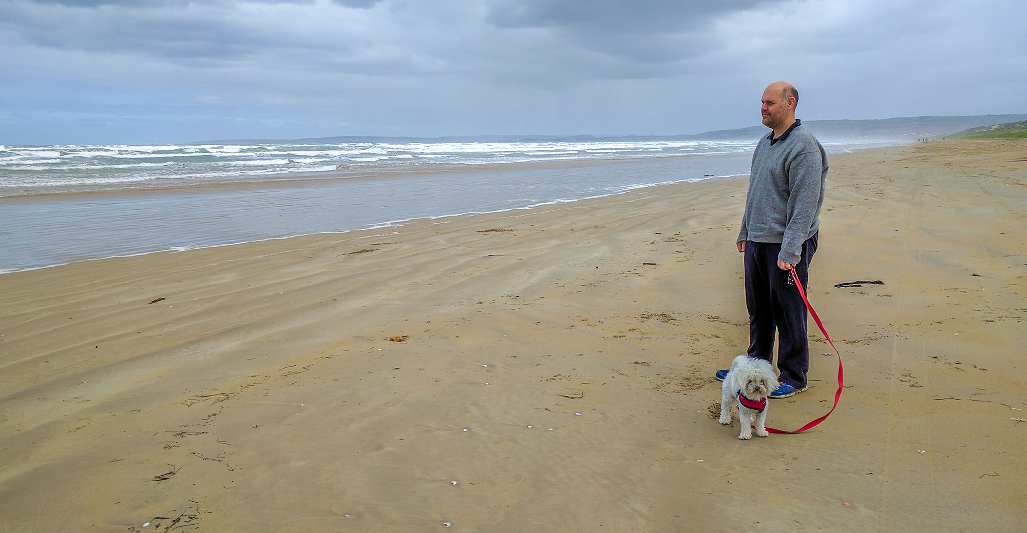
We started by heading to Goolwa – a town on the Murray river – and visiting the towns along the way – Port Elliot, and Middleton. I showed Teresa the route we took on Saturday on the Murray Mouth Tour and the vehicle entrance to the beach (number 1 on the map). We took the opportunity to walk on the beach too – much cooler today and a lot less people.
We then drove over the bridge from Goolwa to Hindmarsh Island and drove to the Murray Mouth outlook (2 on the map) – getting a view of the mouth from another location than Saturday.
The guide on Sat’s tour had recommended the Middleton Tavern for a good pub lunch, so we thought we’d head there. However, as it was still a little early (11am), we thought we’d do a bit of siteseeing first. We stopped at a few locally sourced food stores in Goolwa before looking at some of the countryside (3 on the map) then heading back to Middleton to check out some of the beach houses.
The houses here reminded us both of Portarlington – where most of the houses on the foreshore were expensive and two stories. But get a street or two back from the beach, and the houses rapidly transform to a more regular construction. We did notice one difference… we couldn’t see any houses on the foreshore that were occupied. Whereas Portarlington has quite a lot of houses permanently occupied. It was only a couple of streets back that we noticed signs of permanent habitation.
Lunch was good at the Middleton Tavern (4 on the map). We selected a table outside – perfect for Leo and saving Teresa from being assaulted by the perfumed elderly lunch patrons. We had a chicken schnitzel and a beef parma. The parma was huge and the schnitzel had a really nice crumb that looked like it was locally done (unusual for a pub meal!). We swapped mains half way through so we could sample both meals. Delicious!
After lunch we headed back to the caravan. Teresa stayed this afternoon to recover so she was ready for another caravan move tomorrow. Leo stayed to keep her company.
Mum mentioned that Ba had been stationed at a radar station in Yankalilla during the war, so I thought I’d go and take a look at that, as well as Cape Jarvis.
Cape Jarvis
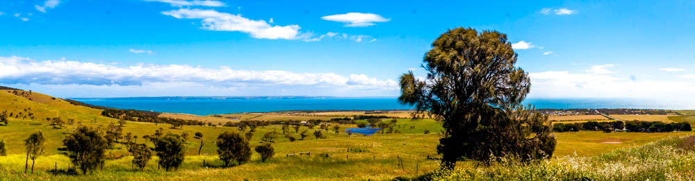
Cape Jarvis is where the ferry leaves for Kangaroo Island, and the drive there is absolutely majestic. There are many beautiful hills to view, and you can usually see either the ocean on the left, or the St Vincent Gulf on the right. And at one place (red spot on the map), I could see water on both sides!
The view down the last hill towards Cape Jarvis is amazing too. I stopped multiple times to take in the view and snap some panoramas. The photos really don’t do it justice – the pale blue sky transitioning into the deep blue ocean with rolling green hills on both sides, and Kangaroo Island in the background. Magic! The only downside was the wind – quite strong and a little chilly. But it helped create the white peaks on the waves, so I can’t complain much.
As I got to the cape (number 5 on the map), the 3pm boat to Kangaroo Island had just left, but I could see the other boat returning so hung around to watch it dock.
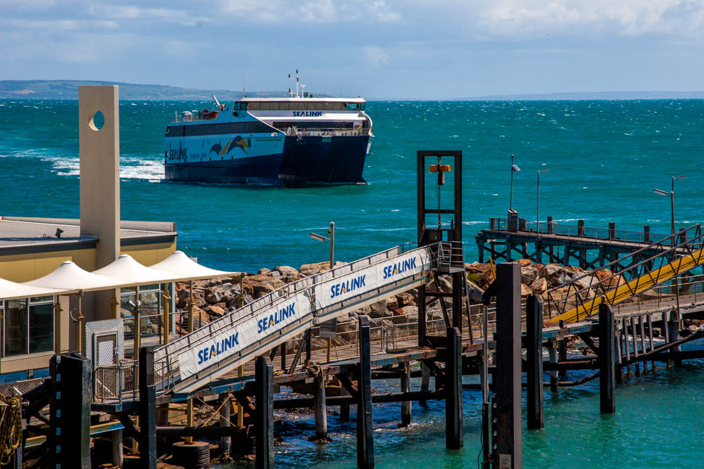
It was quite a detailed, but well executed operation. Unlike the Queenscliff ferry, there is only one car entrance to the boat – the stern. So they drive, on and turn around on the boat ready to drive off at the other end.
They also transport enormous trucks on the boat too. There was a truck with a trailer (with a “Kangaroo Island Freight Service” logo on the side – I love their tag: Daily Freight to the Best Part of the State!) and a second truck with four levels of sheep. From watching the boarding procedure, the trucks back onto the boat so they can drive forward at the other end. I’m impressed at how they can back a truck with a trailer – particularly after trying to back our caravan into a few tight spots on our holiday so far. There were another 5 trucks waiting to board for the return journey. They must time their journeys really well to catch the ferry – particularly with livestock so they’re not waiting for too long.
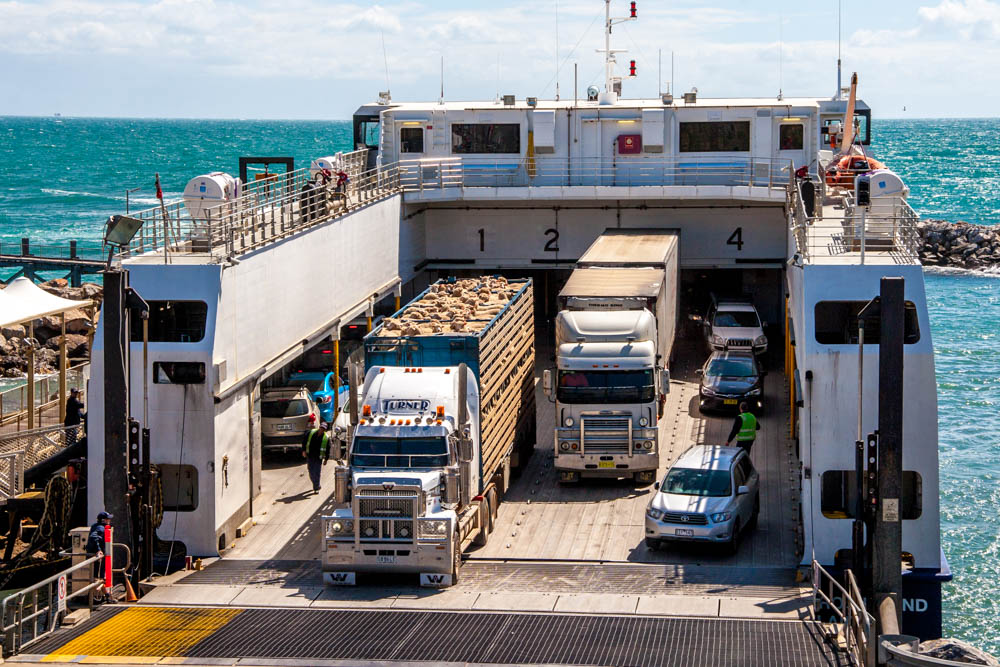
I noticed a couple of tow trucks while I was waiting for the boat, and after all cars were unloaded, I found out why. They backed onto the boat and picked up a couple of cars that couldn’t get off the boat on their own steam. Looks like they had been involved in crashes. Neither were badly damaged, but I could see scratches on the side. I guess if there is no panel beater on the Island, they need to get the cars to shore somehow!
More Views
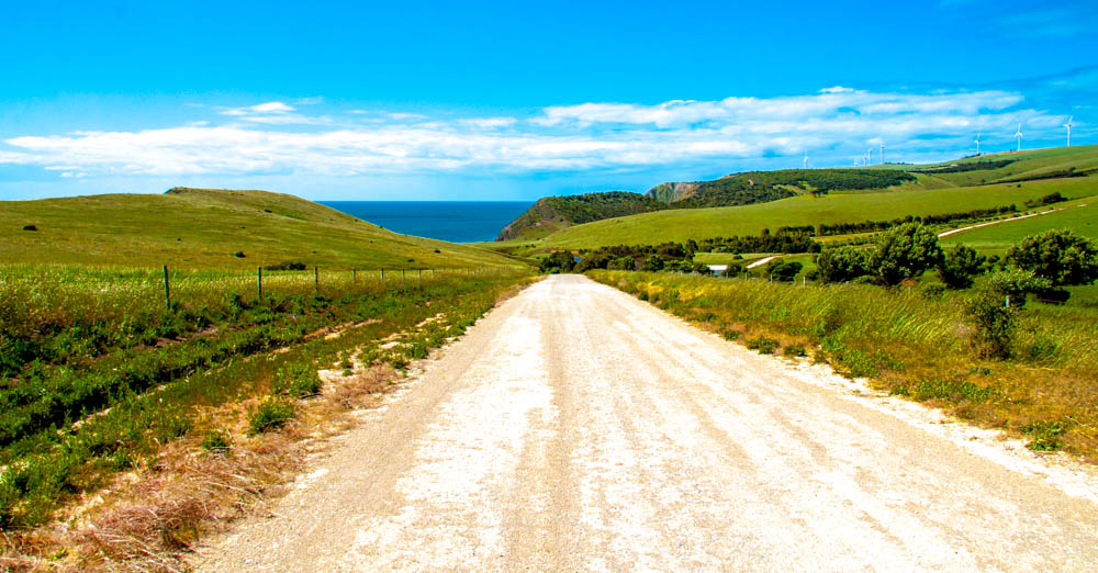
On the way back from Cape Jarvis, I spied a group of windmills and decided to try and get a better photo. I do love being on holidays and taking a side trip on a whim! There was a dirt road that led towards them and Google told me the road met up with the main highway, so off I went. More Faux-4WDing. (Green section on the top map)
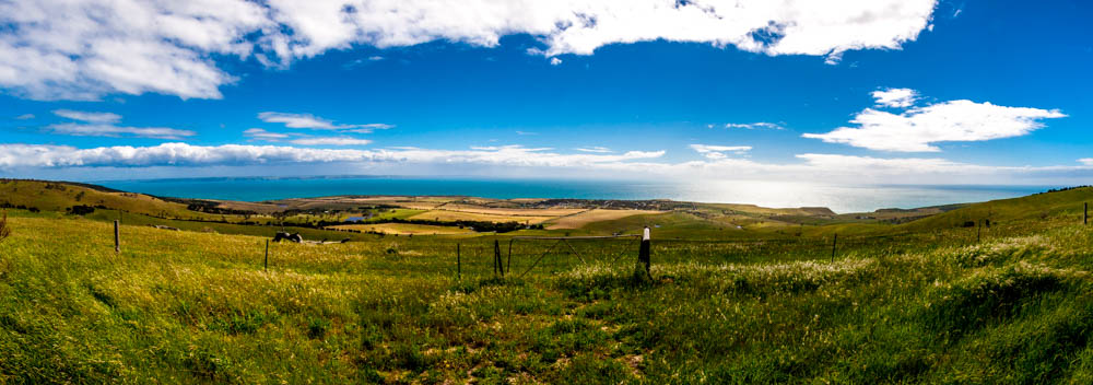
I was glad I went – the views from this other road were spectacular. The road took me down this gully, below
The track then lead up the hill (to the right of the image above) to a little hamlet with 10-odd houses all with spectacular views of the hills and coastline. Again, the photos don’t do it justice. We’ll definitely need to come back to this place and stay a while.
Normanville
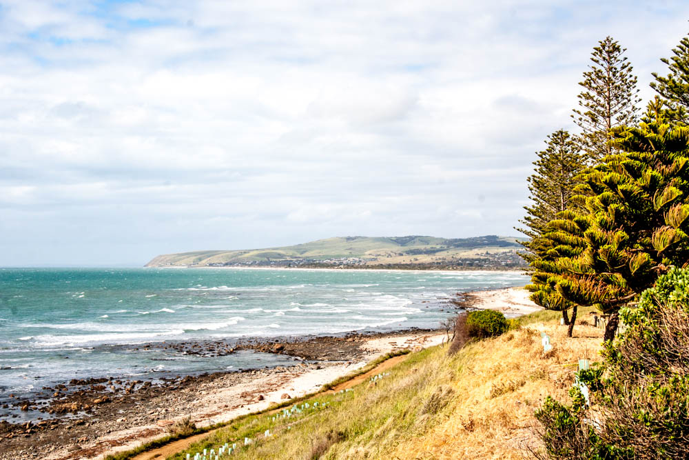
On the way to Yankalilla, I passed the town of Normanville. Here the road that normally followed the top of the hills instead followed the coast for a couple of kilometers. There is a caravan park too. Mental note: stay here next time.
I stopped at a memorial lookout that marked the resting place in the bay of the HMAS Hobart after it was decommissioned in 2002. All sides had mesmerising views. I’ll share just one:
Yankalilla
I remember Ba talking about her days here during the war. Mum said she was stationed at a radar base in Yankalilla and since it was close, I wanted to see what was left (7 on the map).
The answer? Either everything or nothing! I wasn’t able to confirm there was ever a base there at all. I initially tried to search on the Internet for a war base there, but came up empty. I asked a couple of locals and none knew anything about it. I even asked at the local information center (if anyone would know, they would!) but they’d never heard of it! They said someone else had inquired about a base a couple of weeks ago, but couldn’t help him either.
I remember Ba saying they had to keep the location of the radar base secret during the war, but I figured that need was no longer necessary. Seems like they’ve kept the base location a secret to this day.
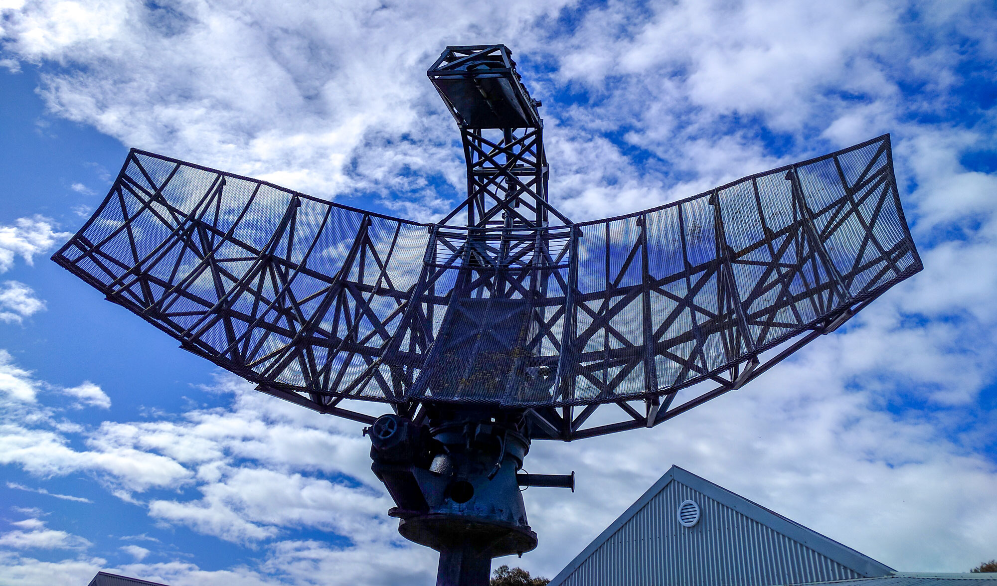
I did find a radar dish at the information center, but it was from a ship not a base.
Slightly disappointed, I headed home (via more rolling hills and winding roads).
Three Weeks!
Tonight marks three weeks on our holiday excursion, and neither of us want it to end. In fact, at lunch we both talked about the possibility of renting out both houses on Phillip Island and travelling the country permanently. I’m not convinced that we could both live in the small caravan and annex space, but we’ll keep the option open.
We have a hard end-date on our holiday now too – 15th November. That means we have at most 2 weeks left, and are over half way.
Robe Tomorrow
Tomorrow we depart Victor Harbor for Robe, on the far south coast of SA. Google says it’s a 4 hour journey, but travelling slower because of the caravan and with regular wee stops for the puppy, it will likely take 5. We’ll head to Murray Bridge, take the road around Lake Alexandrina, then follow the coast. Should be some good scenery all the way.
Yankalilla as a town was a foil to where the radar base actually was.. I can’t remember the name of the town where the base was, but I’m surprised the locals had no idea. Ba and other war survivors had at least 2 “back to” events there. I have just looked at the map and Delaware, much closer to the sea and overlooking the passage between Kangroo Island & the mainland rings a bell. When we were on the K.I ferry Ba had said look up at the cliffs as you approach or leave the ferry terminal and you will see the remains of the “Doover” (Radar) I tried but couldn’t make anything out from the water. Yankallilla is much further inland. Sorry. I should have looked at Google Maps before you set off. Didn’t know you were going for a look though.